HOME / SERVICES
Our Services
Improving visibility into subsurface conditions and reducing risk across infrastructure projects.
Improving visibility into subsurface conditions and reducing risk across infrastructure projects.
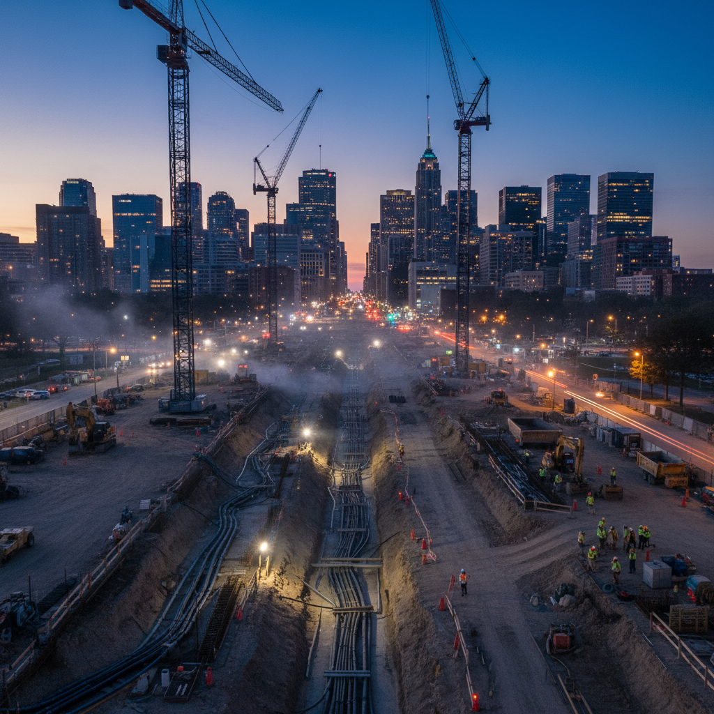
We deliver a structured approach to utility investigation, aligned with industry best practices, to improve the quality and reliability of underground data — moving design teams from assumption to evidence.
Outcome
Enhanced data confidence, reduced design conflicts, and improved constructability.
We provide targeted field services to support both design development and active construction. When utility records or geophysical designations need to be confirmed before excavation, we put eyes on the asset.
Outcome
Improved field certainty and reduced risk of unforeseen conditions.
We provide practical, hands-on support to manage contracts, coordinate stakeholders, and maintain control over project scope, cost, and schedule throughout the construction lifecycle. Our approach is grounded in real project delivery experience, ensuring that contractual obligations are properly administered and project information is accurately tracked and communicated.
Outcomes
Improved control over cost and scope · Reduced exposure to claims and disputes · Clear communication across all stakeholders · Better visibility into project performance · Structured and well-documented project execution.
Our role is to support informed decision-making and reduce uncertainty at every stage of the project. We focus on delivering work that translates directly into better design, safer construction, and stronger contract outcomes.
Compile records, correlate survey, apply geophysical designation — build a defensible picture of subsurface conditions.
Use targeted field exposures to confirm position at the points where conflict and risk concentrate.
Translate findings into deliverables, contract action, and coordinated decisions across owner, designer, and constructor.
SUE is a structured engineering practice for managing the risk of underground utilities. It uses records research, surface geophysics, and physical exposure to identify and characterize buried utilities at four standardized quality levels (QL-D through QL-A) defined in ASCE 38.
QL-D — records review and existing utility records compilation.
QL-C — correlation of QL-D records with visible surface features and survey data.
QL-B — surface geophysical designation, typically using ground-penetrating radar (GPR) and electromagnetic locators to mark approximate horizontal positions.
QL-A — physical verification through daylighting or potholing (usually hydrovac), confirming exact horizontal and vertical position.
Daylighting (also called potholing) is the physical exposure of a buried utility through controlled excavation — typically with a hydrovac truck — to confirm its exact horizontal and vertical position. It is the QL-A method in ASCE 38 and is used at critical crossings, design conflict points, and wherever subsurface accuracy is essential before excavation.
Transportation and transit, power and utilities, municipal infrastructure, and private development — primarily in Ontario and across Canada. Typical engagements involve utility-dense urban corridors, brownfield sites, and projects with significant stakeholder coordination.
It reduces exposure to utility conflicts, improves design accuracy and constructability, minimizes rework and change orders, supports safer construction, and improves coordination across owners, designers, contractors, and utility owners. Industry studies have repeatedly shown SUE materially reduces project costs compared to relying on records-only utility data.
Contract administration is focused on the contractual relationships, deliverables, change management, and documentation between owner and contractor across the construction lifecycle. It complements project management by maintaining control over scope, cost, and schedule through proper contract execution rather than day-to-day site supervision alone.
Engage early — we'll help your team scope the investigation that fits the risk profile of the project.